Latest District Monitoring Well Information
TEXAS WATER DEVELOPMENT BOARD MONITORING WELLS
Comanche County
Blanket, Texas - Middle and Lower Trinity
Monitor well #4110321 is located off County Road 145, near Blanket, Texas. It is 307.0 feet deep with a land elevation of 1712 feet and monitors the Travis Peak (Hensell/Pearsall/Hosston) formation of the Trinity aquifer in the western portion of Comanche County. Click here for further information for monitor well #4110321
Coryell County
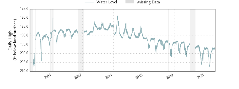
Pancake, Texas - Middle and Lower Trinity
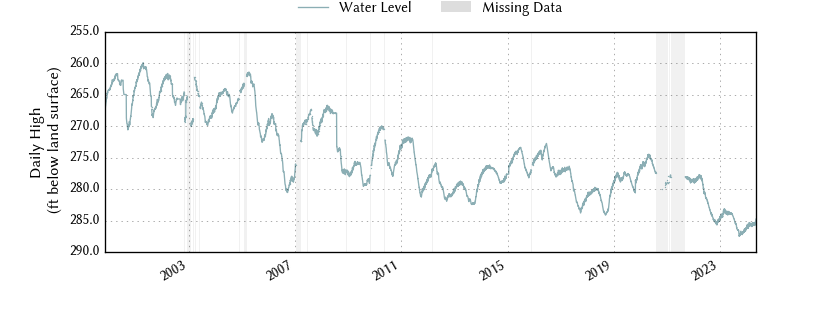
Monitor well #4026201 is located off FM 217, near Pancake, Texas. It is 908.0 feet deep with a land elevation of 1157 feet and monitors the Travis Peak (Hensell/Pearsall/Hosston) formation of the Trinity aquifer in the north portion of Coryell County. Click here for further information for monitor well #4026201
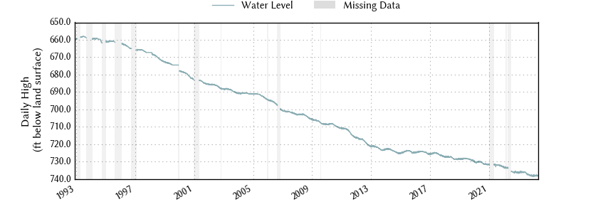
Gatesville, Texas - Lower Trinity
Monitor well #4035404 is located off S Hwy 36, Gatesville, Texas. It is 755.0 feet deep with a land elevation of 818 feet and monitors the Hosston formation of the Trinity aquifer in the central portion of Coryell County. Click here for further information for monitor well #4035404
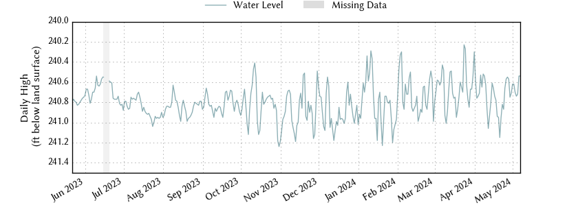
Copperas Cove, Texas - Middle Trinity
Monitor well #4049601 is located off FM 116, Copperas Cove, Texas. It is 440.0 feet deep with a land elevation of 1018 feet and monitors the Hensell formation of the Trinity aquifer in the southwestern portion of Coryell County. Click here for further information for monitor well #4049601
Erath County
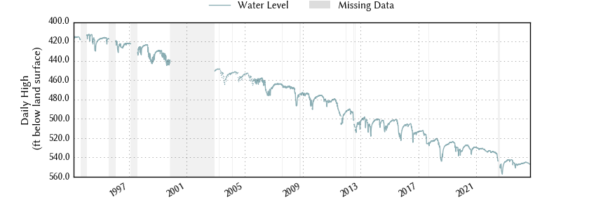
Stephenville, Texas - Middle and Lower Trinity
Monitor well #3155504 is located on US Highway 281, south of Stephenville, Texas. It is a 332.0 feet deep with a land elevation of 1235 feet and monitors the Twin Mountains (Pearsall/Hosston) formation of the Trinity aquifer in the central portion of Erath County. Click here for further information for monitor well #3155504