Geology of the Middle Trinity GCD
Introduction
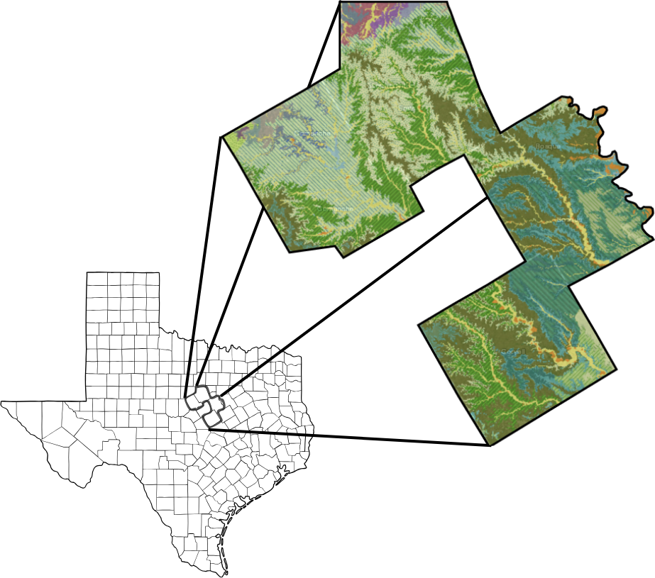
The Middle Trinity Groundwater Conservation District (MTGCD) is underlain by complex and hydrogeologically significant rock units that play a critical role in water availability and quality. This page explores the geology of the Middle Trinity region, including Erath, Comanche, Coryell, and Bosque Counties. It focuses on rock layers, structure, groundwater systems, and explains why the geology matters for water-resource sustainability.
Why Geology Matters for Groundwater
Geology is the study of Earth’s materials and how they are stacked, broken, and shaped below the surface, and these properties directly control how groundwater is stored and moves. In the Middle Trinity Groundwater Conservation District, layers of rock and sediment with high porosity and permeability, such as certain sands and fractured limestones, serve as productive aquifers, while tighter layers, such as clay‑rich or unfractured rocks, act as barriers that slow or block flow. These contrasts create an uneven distribution of groundwater, affecting how deep wells must be drilled, how much water they can produce, how quickly aquifers recharge, and how vulnerable they are to depletion or contamination. Thinking of the subsurface as a layered system, with some beds behaving like sponges and others like lids, helps explain why geology is fundamental to managing, protecting, and planning the long‑term use of the Trinity Aquifer’s groundwater resources.
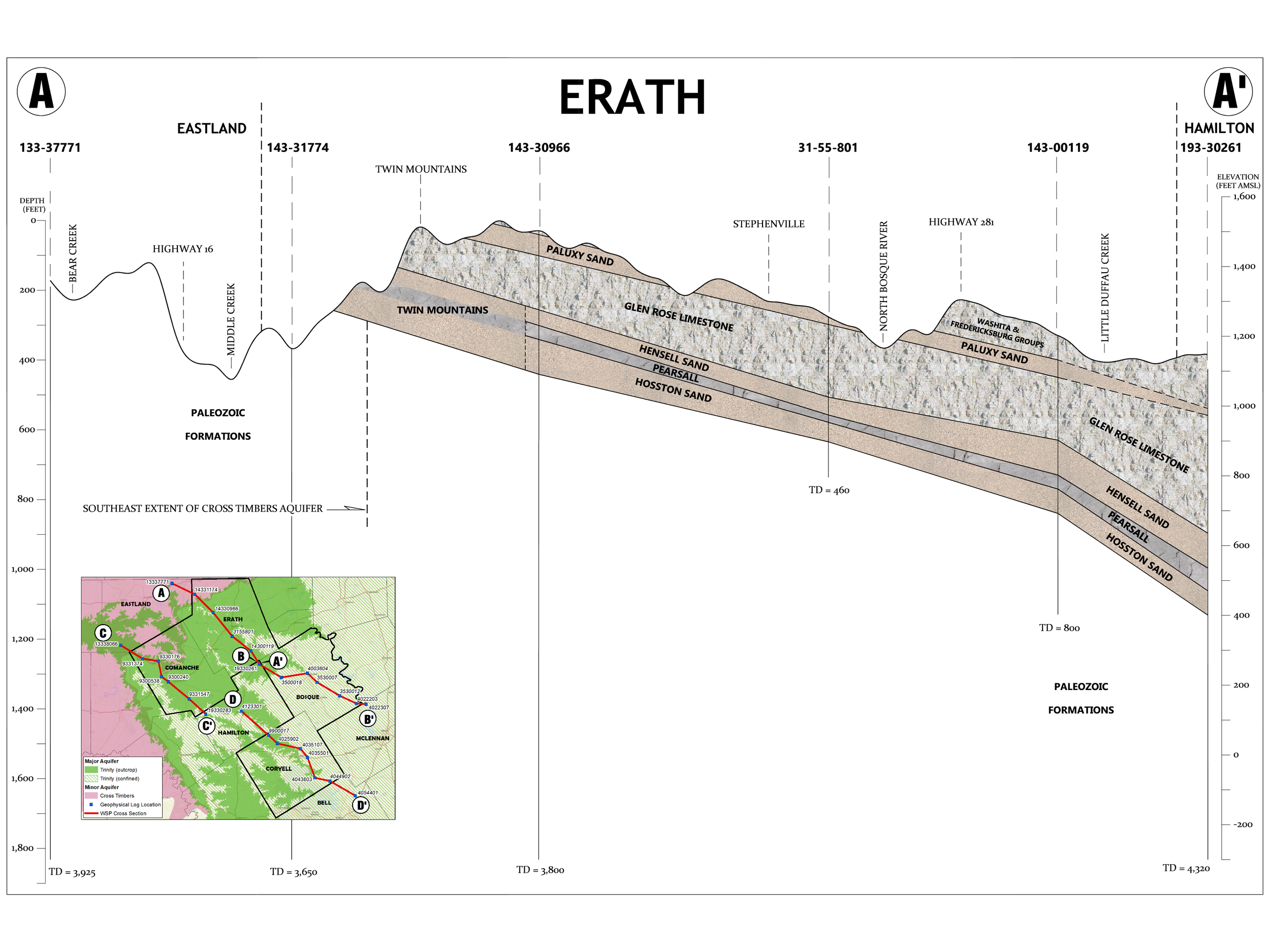
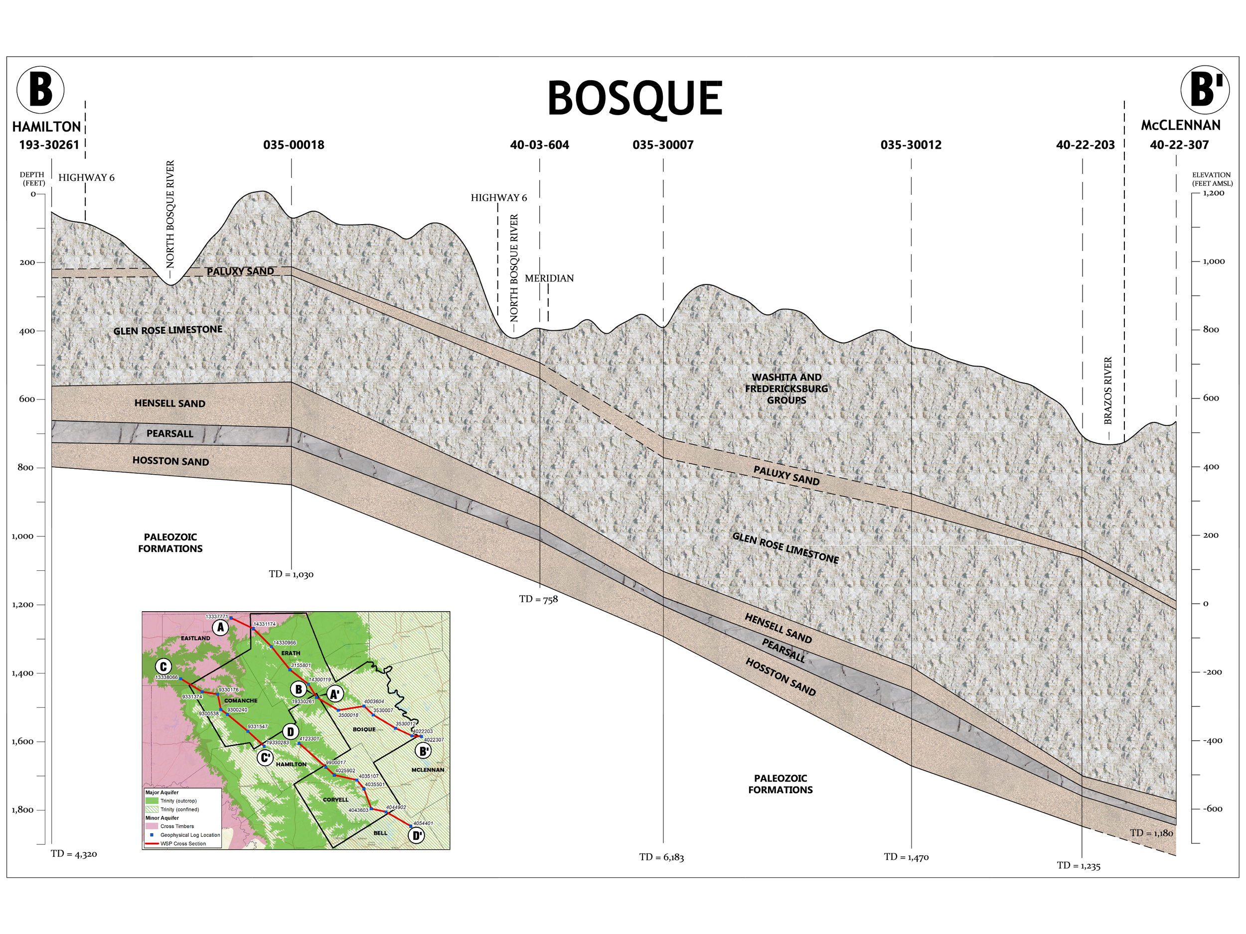
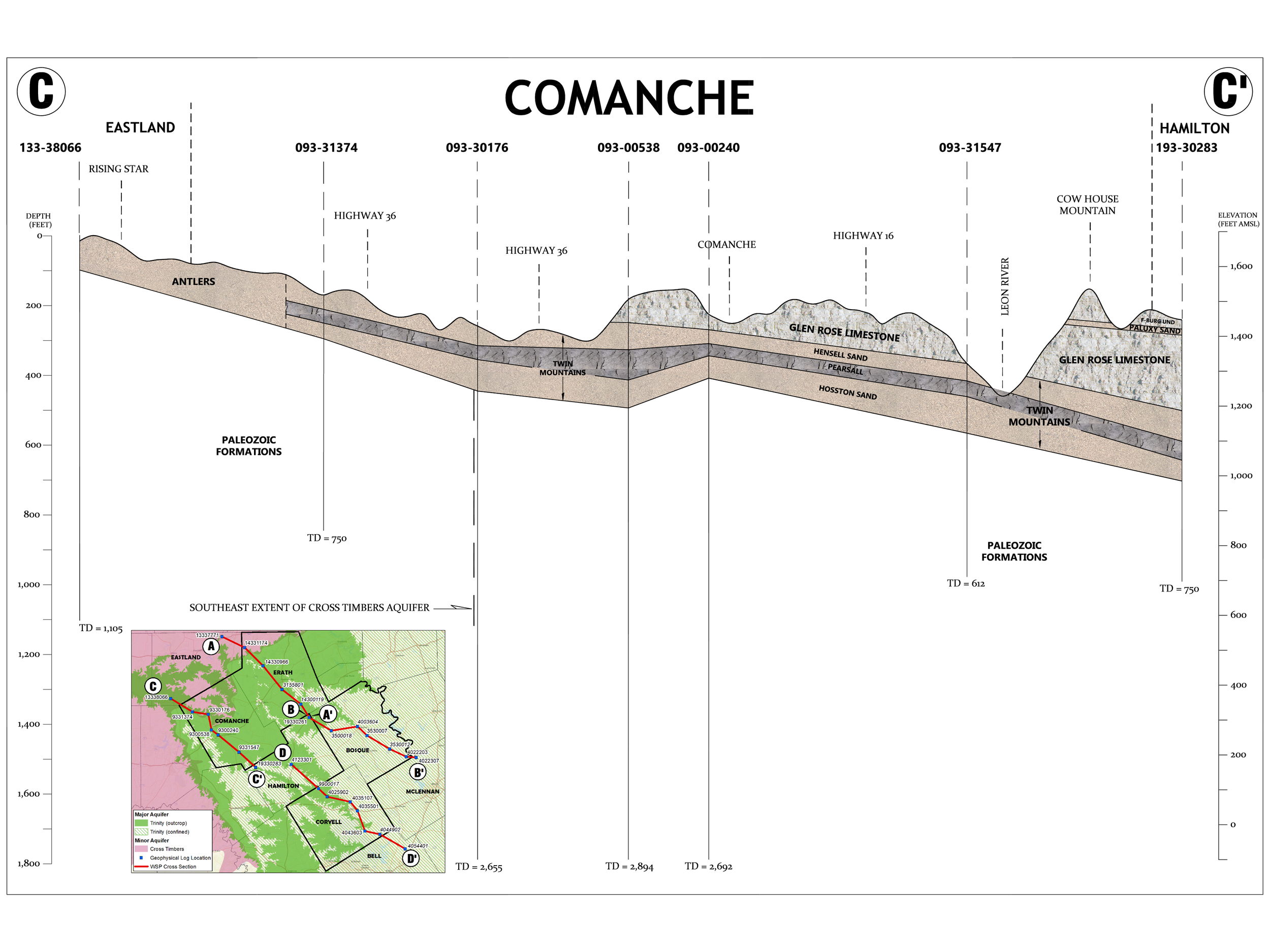
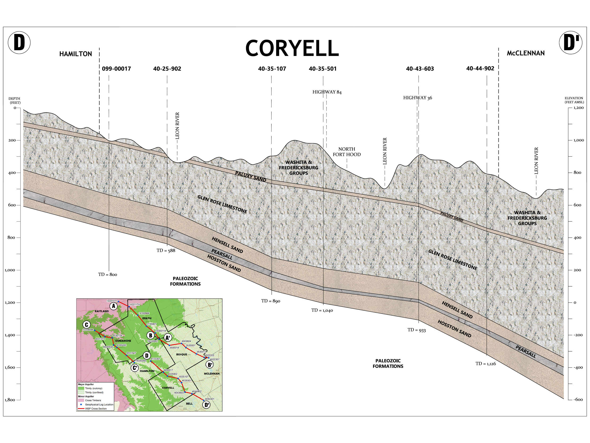
Aquifer Cross Sections
This diagram section uses simplified cross‑section drawings to show how the rock layers beneath each county are stacked, tilted, and connected, and how those layers make up the Trinity Aquifer system. By looking at these side‑view “slices” through the earth, you can see where key sands and limestones that hold groundwater are shallow, where they dip deeper, and how rivers and land surface features intersect them. Understanding how these rock layers are arranged helps explain why some wells are shallow while others must be drilled much deeper, and why water levels and water quality can change from one location to another, depending on which part of the Trinity Aquifer the well taps into. This visual context bridges the gap between basic geology and real‑world groundwater issues.
Bosque County
Comanche County
Coryell County
Erath County